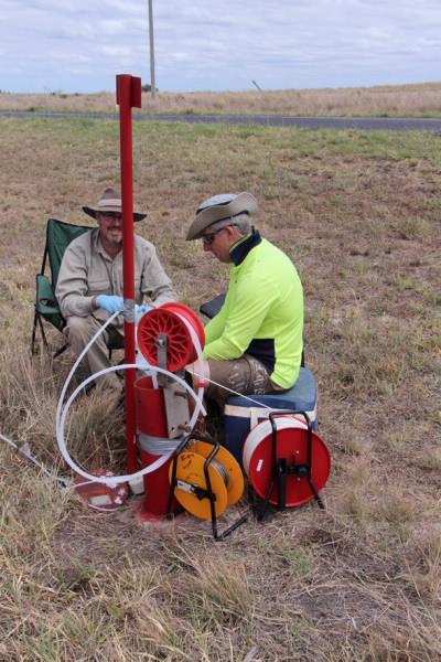

Published on the 25th November 2015 by ANSTO Staff
ANSTO has participated in a study evaluating the extent of natural groundwater connectivity between an Australian overlying aquifer and deep coal seam gas resources that can be applied to developments worldwide.
Coal seam gas, or coal bed methane production, an increasingly important resource to the global energy industry, is the focus of environmental questions as it requires the joint extraction of large quantities of groundwater. Production can have an impact on groundwater quality and quantity in adjacent or overlying aquifers that are used to support irrigated agriculture, stock and domestic water supplies.
The study, which has been published in Scientific Reports, was funded by the Australian Government’s Cotton Research and Development Corporation. It was conducted in the Surat Basin in south east Queensland and undertaken in association with the University of NSW (UNSW) Connected Waters Initiative Research Centre, ANSTO, Royal Holloway, University of London and the University of East Anglia.
The research, which includes the development and testing of a new methodology to evaluate water connectivity, provided independent baseline information for those communities near Dalby using groundwater for irrigation in proximity to coal gas seam developments.
By analysing the geochemistry of groundwater from 30 boreholes throughout the Condamine Alluvium, the researchers were able to determine if there was a geochemical fingerprint that indicated there was movement between the Walloon Coal Measures (a stratified geological formation that contains coal and coal seam gas), and the Condamine Alluvium groundwater system.
The authors noted that there are natural pathways of hydraulic connectivity through faults, fracture networks, and permeable sedimentary formations. But connectivity can also occur through abandoned exploration wells and faulty well casing.
The research indicated that there is hydraulic connectivity between the Walloon Coal Measures and the Condamine Alluvium but the extent is low.
The investigations also determined that there was a low concentration of methane measured throughout the Condamine Alluvium.
“We were all expecting mixing of water sources, instead we found a gas diffusion process that has probably been operating for a long time,” said ANSTO environmental researcher Dr Dioni Cendón, who was involved in the organisation of the study, geochemistry analyses, field sampling and the interpretation of results.
“ANSTO brings considerable expertise in the use of tools and techniques to measure changes in water isotopes that enable us to characterise water masses and to trace water and its interaction above and below the earth,” he said.
Because methane derived from subsurface sources has a unique isotopic signature, it is possible to identify it in groundwater and air.
In this study, ANSTO measured levels of tritium (3H), a naturally occurring radioactive isotope of hydrogen, to gain information about groundwater residence times, water recharge processes and potential groundwater mixing. The radioactive emissions of tritium can be counted using liquid scintillation.
Sulfate and nitrate anions were measured at ANSTO using ion chromatography to provide insight into anaerobic process deep within an aquifer.
“Our measurements of the carbon-13 of dissolved inorganic carbon using mass spectrometry, told us something about the source of inorganic carbon in the groundwater,” said Cendón.
A continuous mobile methane survey adjacent to coal seam gas developments led by Associate Professor Bryce Kelly at UNSW was also used to determine the source of the methane. The chemical signature at four isolated sites indicated it was probably sourced from the Western Coal Measures.
“Methane gas can migrate upwards into other aquifers but that does not involve mixing of waters, just the gas migrating. The water from the alluvium, which is used by irrigators, and the gas production water are chemically very different, therefore any mixing will be quite evident,” explained Cendón.
“It was important to show the growers and other involved parties how hydrogeochemical studies with different natural radioactive traces and stable isotopes can provide valuable baseline studies and/or separate natural and anthropogenic processes,” he said.
The information is also being shared more widely with government and the scientific community.
The Walloon Coal Measures and Coal Seam Gas extraction
The Walloon Coal Measures (WCM) consists primarily of sandstone, siltstone, mudstone and coal up to 700 metres thick, however the thickness of the coal makes up less than 10 per cent of the total thickness of the unit.
The entire area sits within the Surat basin, which is part of the Great Artesian Basin.
Coal seam gas collects in underground coal seams by bonding to the surface of coal particles. The seams are filled with brackish water and it is the pressure of the water that keeps the gas as a thin film on the surface of the coal.
Coal seam gas is extracted by drilling a well vertically through rock strata until reaching the coal seam, at which point the well may also be drilled out horizontally to increase access to the methane gas. Coal seams contain both water and gas. During coal seam gas operations the water must be pumped out of the coal seam to lower the pressure and allow the gas to flow to the surface.
DOI: 10.1038/srep15996
